

660 kilometres of gravel road, breakdown included
West Australia – Red, wild, vast, scorching

Rust-red tracks, termite mounds, boab trees – and somewhere deep in the outback, a breakdown that turns everything upside down. A Jeep journey on the notorious Gibb River Road. Between adventure and the ancient Dreamtime culture of the Miriwoong Aboriginals.
Erschienen in:

Deutschlands größtes Naturreise-Magazin
12 Seiten | Text & Fotos
Everyone has an Australia story. Venomous snakes, spiders, crocodiles, heatstroke, dying of thirst, fatal breakdowns – what my wife Annette and I hear before our first trip there is material for a horror story. Is it really as bad as they say? We’ll find out – with a healthy dose of respect.
The introduction to our off-road vehicle takes a full two hours
The introduction to our rental off-road vehicle in Broome takes a full two hours. Stephan explains every lever of the 2.8-tonne Toyota HiLux with rooftop tent, kitchen and awning.
My head is spinning.
After shopping for eight days in the wilderness, we set off into a landscape that looks as if it’s from another planet. Countless termite mounds line the roadside like abstract sculptures of ochre-red earth. Between them, boab trees stretch their gnarled branches towards the sky.
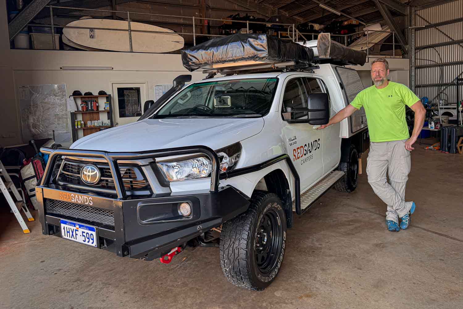
The introduction to our off-road vehicle – including tent assembly, on-board electronics, tyre changes, etc. – takes a full two hours.
After four hours, the tarmac ends. The notorious Gibb River Road begins. We let air out of the tyres – on the loose gravel, the larger contact area improves traction.
The first kangaroo crosses the road in an elegant arc. We cheer and feel childishly delighted! Swallows dart in front of the bonnet, a flock of emerald-green parakeets explodes from the undergrowth. The wilderness begins!
A 750-metre cave passage bores through the Napier Range here
Just before sunset, we reach Tunnel Creek in Bandilngan National Park. A 750-metre cave passage bores through the Napier Range here – a relic of a reef that formed beneath a tropical sea 350 million years ago. It is Western Australia’s oldest cave system.
In some places, faint daylight falls on the ground. We’re completely alone here. We scramble over rocks, startling small frogs that save themselves with a leap into the dark water.
The cave is also said to be home to freshwater crocodiles. Unlike their dangerous relatives, the saltwater crocodiles, they are considered shy and only attack humans when they feel threatened. We carefully feel our way through shadowy passages, but no reptile shows itself.
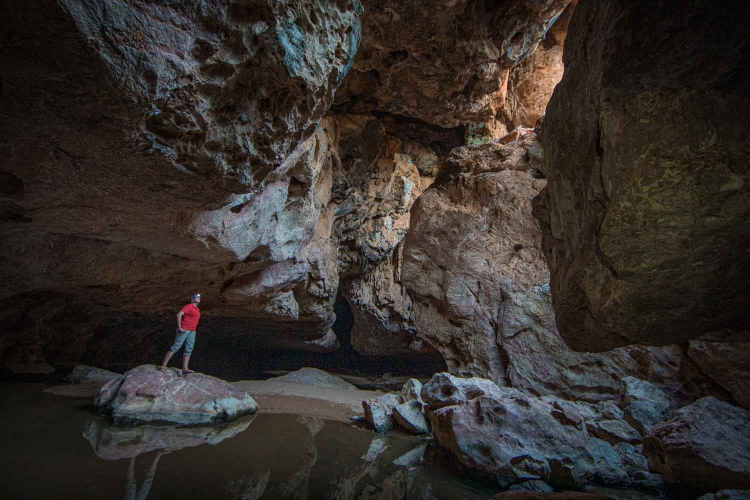
Annette in Dimalurru Cave, also known as Tunnel Creek.
At around five in the morning, I am woken by birdsong. Black cockatoos croak in the treetops, corellas noisily squabble over the best perches. Kangaroos hop through the dew-damp grass.
Thirty to a hundred metres of rock walls frame the riverbed
We hike into Windjana Gorge. Thirty to a hundred metres of rock walls frame the riverbed of the Lennard River. I watch a rainbow bee-eater on a branch – it suddenly takes flight, snatches an insect, lands at precisely the same spot and strikes its prey with full force against the wood.
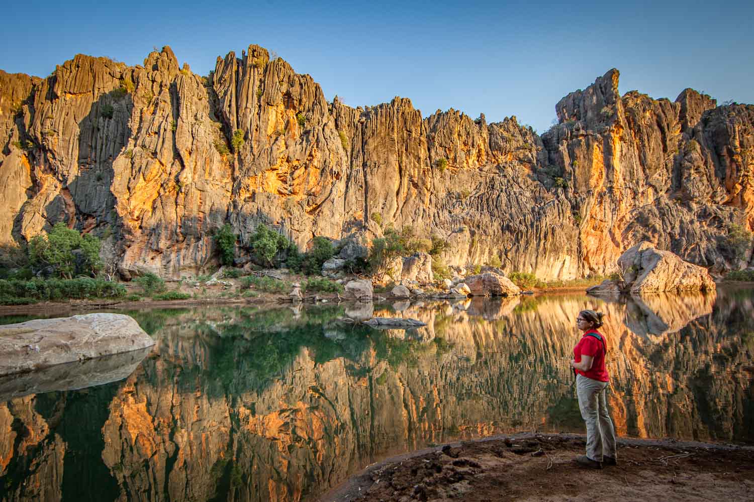
Morning walk in Bandilngan (Windjana Gorge).
Back at the car park, we shake the red dust from our shoes and roll back onto the endless Gibb River Road. The first road train approaches. First just a wisp of dust on the horizon, then a dull rumble.
The rumble swells, a wall of dust rushes past
In Western Australia, these giants reach lengths of up to 53 metres and weights of over 175 tonnes – they are the world’s longest road-legal vehicles. Annette eases off the gas and steers as far as possible onto the shoulde.
The rumble swells, a wall of dust rushes past, the ground vibrates. Seconds later, the red wasteland swallows the noise. Silence.
Is it really as bad as they told us? Not so far. So far, it’s breathtaking.
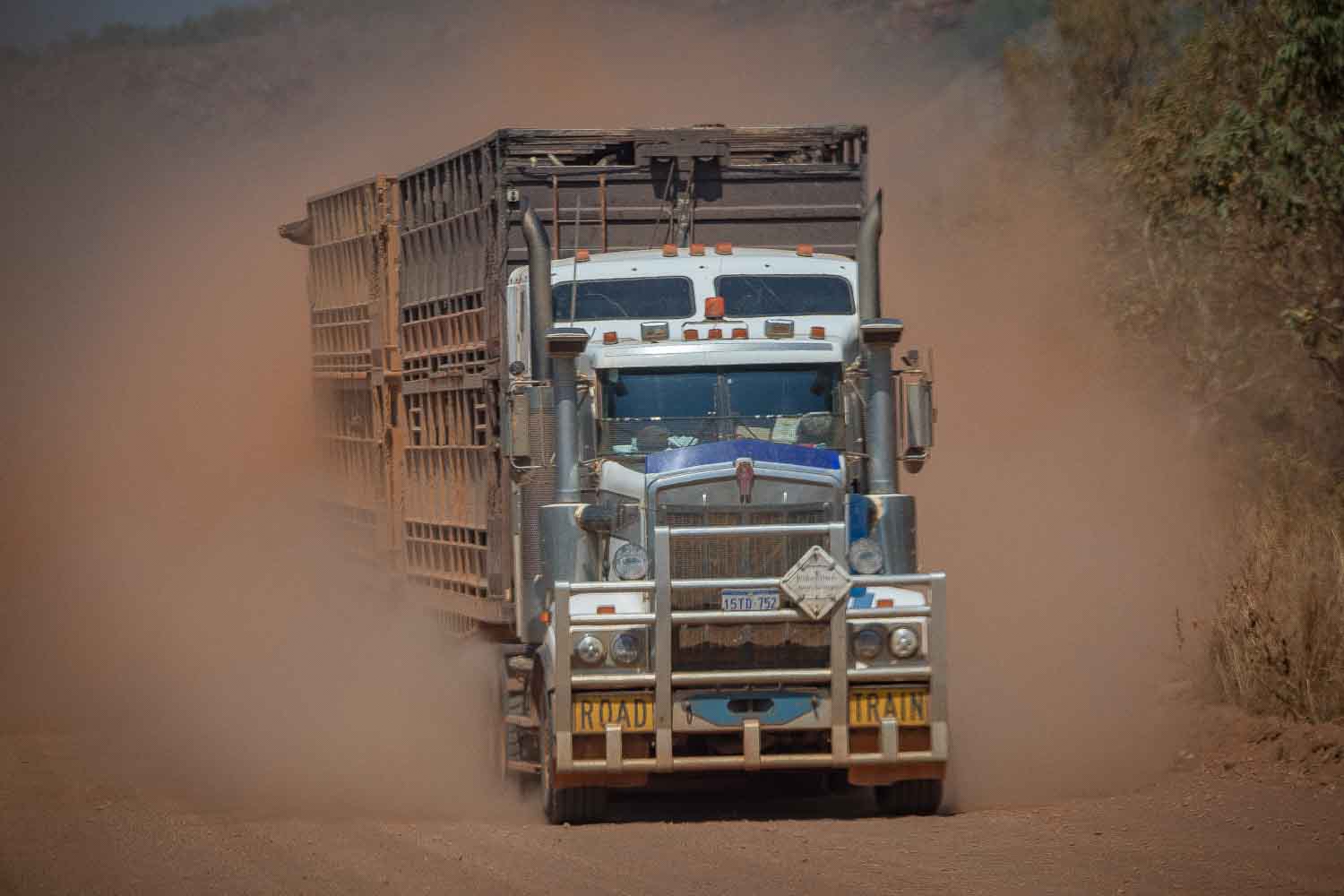
A mighty road train thunders through the dust clouds of the Gibb River Road.
The dusty Gibb River Road winds on through gently undulating terrain of reddish earth. Spinifex grass and acacias have been withstanding the extreme conditions here for thousands of years.
The Kimberley region covers 423,000 square kilometres – larger than Germany. We feel like two grains of sand in a rust-coloured desert.
Crystal-clear water plunges over sandstone steps into a pool below us
We reach Bell Gorge car park. It is well over thirty degrees. After a short descent, we stand at the waterfall’s edge. Crystal-clear water plunges over sandstone steps into a pool below us.
Two swimmers have claimed the natural oasis. Rock formations, sculpted over millions of years, glow in warm ochre tones.
For the Ngarinyin, the traditional custodians of this land, every gorge and every waterfall is sacred. The Wandjina, powerful creator spirits, are said to have shaped the landscape and live in the deep waterholes ever since.
They bring the monsoon rains – and punish those who break their laws with lightning, floods and cyclones.
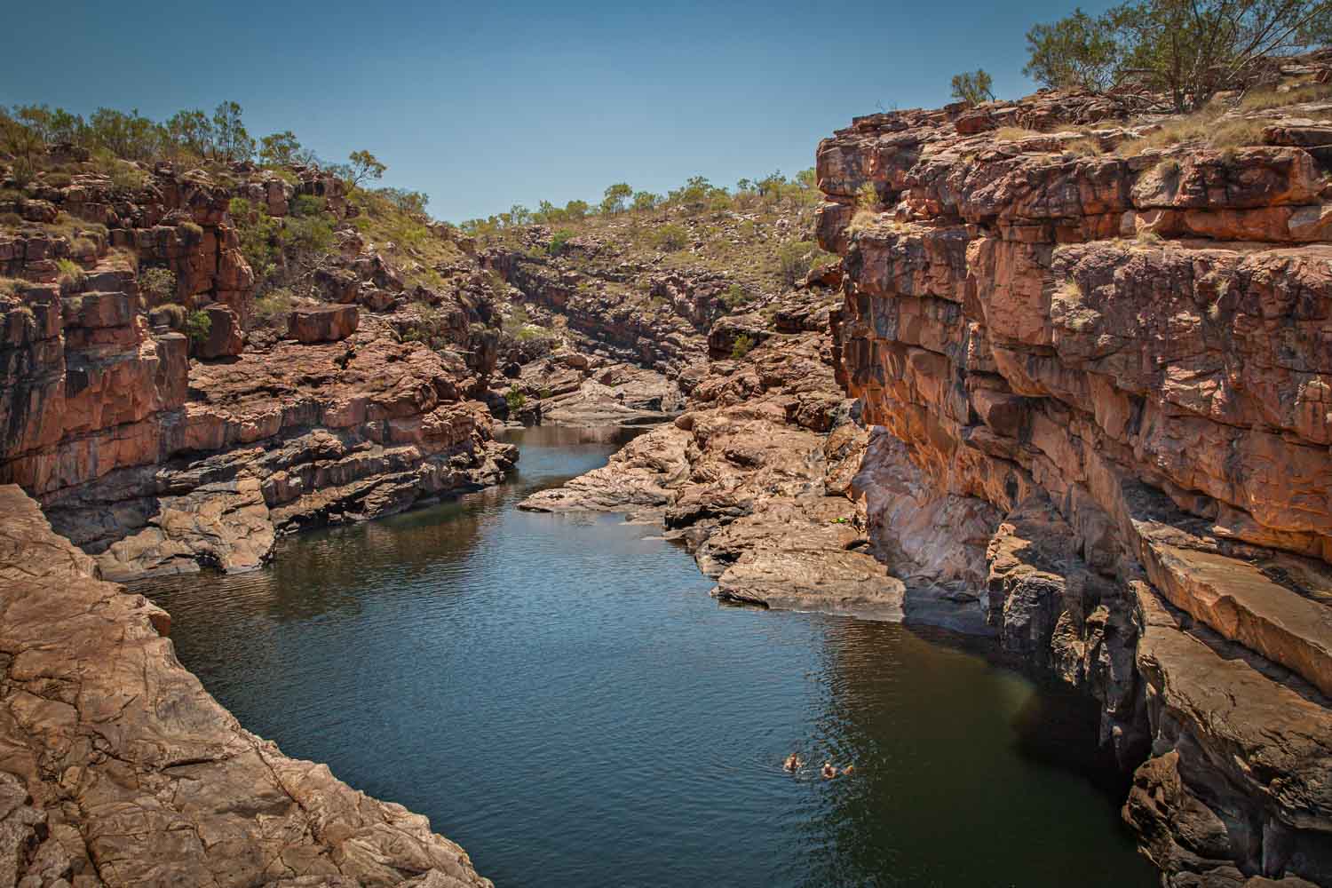
Two swimmers have claimed a natural oasis in Bell Gorge – crystal-clear water pools between rugged sandstone walls.
After one last look at the shimmering pool, we climb back to the car park. Our next destination is Mount Elizabeth Station – thirty kilometres of gravel track, what feels like an eternity.
The 200,000-hectare cattle station was founded in 1945; today, over 6,000 head of cattle graze here. We see only a few of them – the vastness swallows them.
Instead, we meet off-road drivers from around the world who gather at the campsite to swap stories.
A white sandy beach greets us
At sunrise the next morning, a many-voiced bird orchestra wakes us. Peaceful doves coo, redcollared lorikeets squawk and somewhere in the undergrowth a babbler rustles. Twenty kilometres of bumpy track later, we reach Warla Gorge.
A white sandy beach greets us, with still, emerald-green water shimmering behind it. And once again, we are entirely alone.
In a eucalyptus tree, I spot a sulphur-crested cockatoo. With its powerful beak, it deftly cracks hard seed pods. These intelligent parrots are among the few bird species capable of using tools – they hold small sticks with their feet to scratch their heads and backs.
The cockatoo’s call cuts through the silence – a piercing, metallic shriek. Seconds later, a second answers, then a third. Soon a noisy chorus fills the gorge.
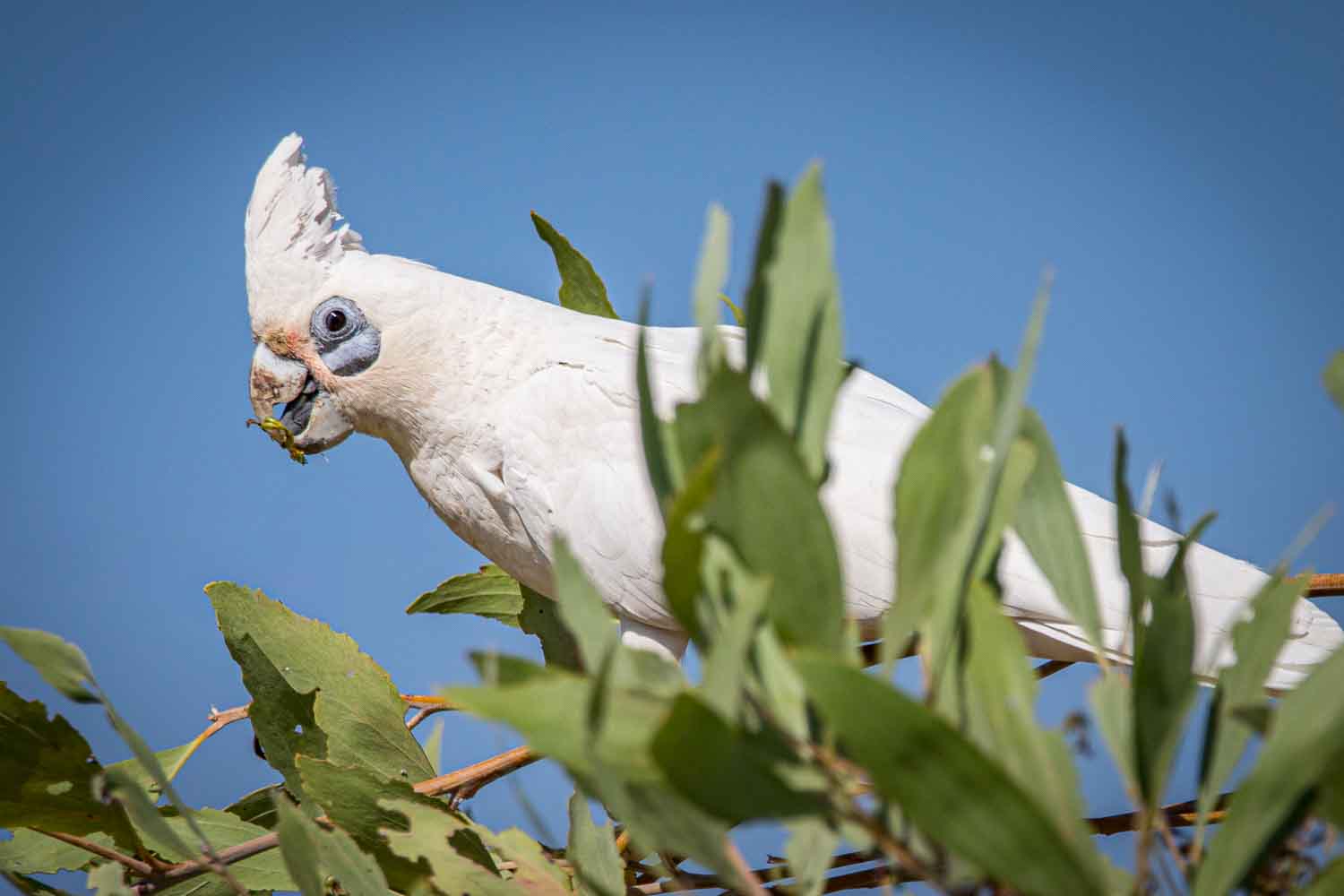
A sulphur-crested cockatoo deftly nibbles eucalyptus seeds in Warla Gorge.
Back to the Gibb River Road. We still have 320 kilometres to go to Kununurra. The sun stands high, dust dances in the light, and the Kimberley spreads before us like a rust-gold ocean without a shore.
Just after midday, an unusual sound. A metallic grinding from beneath the vehicle. Annette brakes, I crawl under the off-road vehicle and see that the mounting for the 140-litre diesel tank has broken away on one side.
The tank hangs dangerously low, just a few centimetres from the sharp-edged gravel. A collision could tear it open – leaking diesel, sparks from friction, in the worst case fire.
The midday heat bears down, forty degrees, no shade
I phone the car hire company, who promises swift help. The midday heat bears down, forty degrees, no shade. After an hour, a dust-covered off-road vehicle roars up.
Mark Sulman from Ellenbrae Station, ten kilometres away, climbs out, shakes my hand in silence and throws himself onto the thorny gravel as if it were a padded mattress. In the outback, you save words and don’t fuss.
After ten minutes, a ratchet strap is firmly around the tank.
Mark examines his work: „I wouldn’t call it safe – but you’ll make it to our station.“ Mark is the embodiment of the bush mechanic – in the Kimberley, improvisation becomes a lifesaving engineering art.
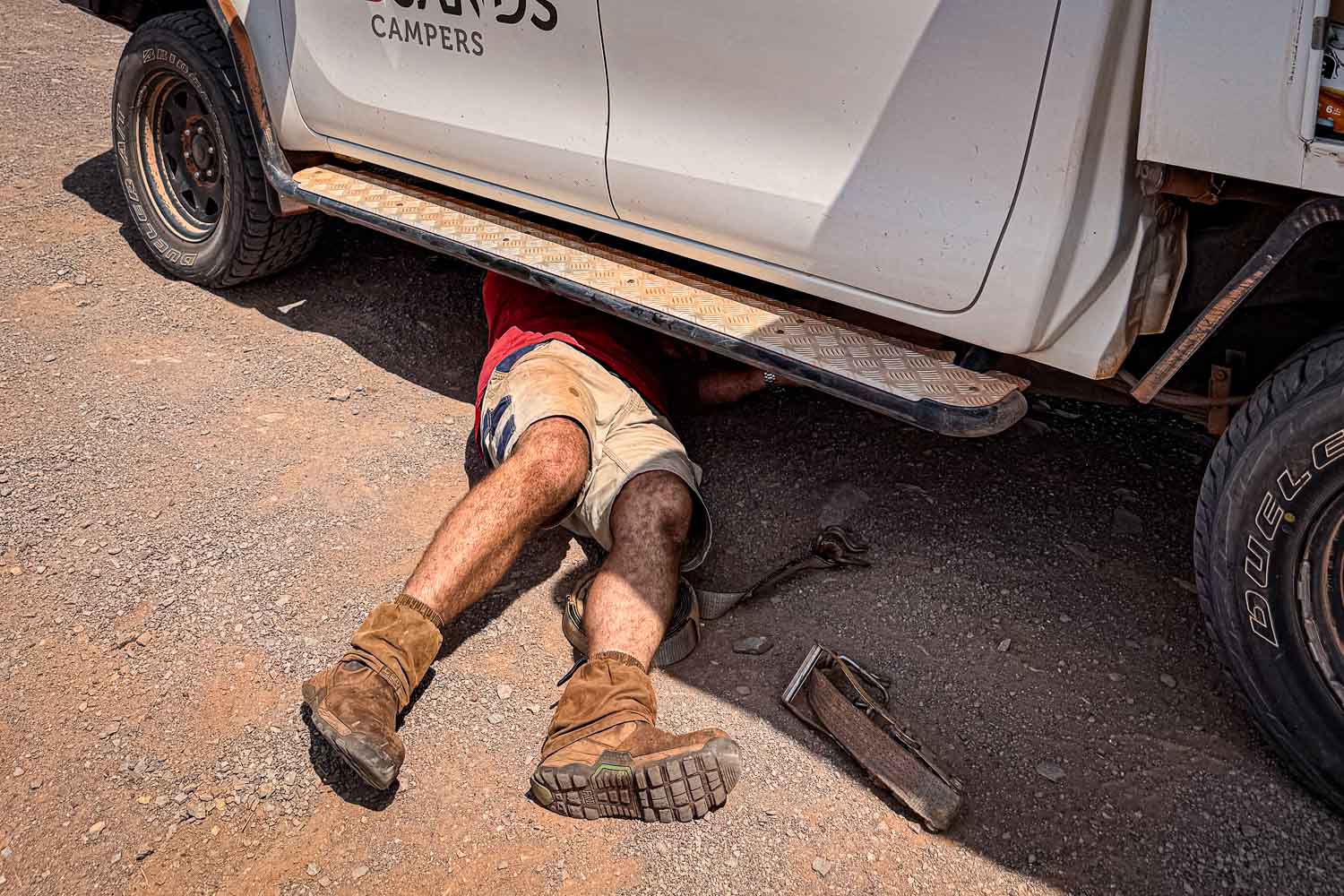
A stroke of luck: Mark Sulman makes a makeshift repair, enabling us to reach the station ten kilometres away.
Ten kilometres later, we reach an oasis amid burnt earth – Ellenbrae Station. Three weeks ago, a bushfire raged here, narrowly missing the station buildings. Annette and I sit gratefully on the veranda, enjoying coffee and freshly baked scones with clotted cream.
Fiona, Mark’s wife and station manager, suddenly fixes her gaze on a spot at the railing. A rare crimson finch displays its brilliantly crimson face. These splendid finches inhabit tropical grasslands. The bushfire presumably destroyed nesting sites, which is why some birds have migrated to the station.
The area covers around 4,000 square kilometres
Mark and Fiona have been running the station since 2021. The area covers around 4,000 square kilometres, almost four times the size of Hong Kong. At the end of September, they close up and fly on holiday.
But someone stays behind: from October to March, when the rivers burst their banks and the Gibb Road becomes impassable, a caretaker remains here alone. Only when the waters recede at the end of March do Mark and Fiona return.
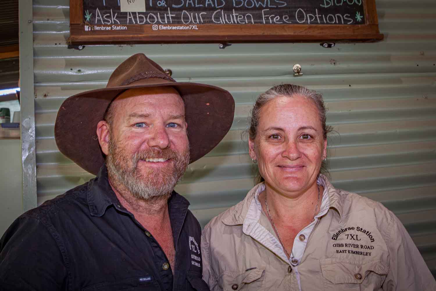
Mark and Fiona Sulman, the warm-hearted proprietors of Ellenbrae Station.
The next morning, the tow truck arrives. Driver Darren could have stepped out of a Mad Max film: cigarette butt in the corner of his mouth, mirrored sunglasses, a slouching gait.
For three and a half hours, we rattle along beside Darren in the cab over the track to Kununurra, past the Cockburn Range, whose rust-red and ochre sediment layers reveal millions of years of geological history.
Darren shifts up and zooms past everything
Then suddenly – tarmac. Ahead of us, roadworks, a red light, five waiting cars, no oncoming traffic. Darren shifts up and zooms past everything. I stare at him in horror. He grins.
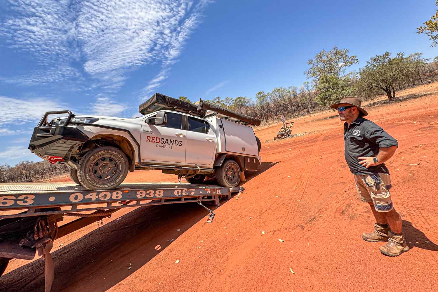
After the tank bracket breaks, our hire car is towed over 230 km to Kununurra.
Arriving in Kununurra, we swap the broken-down vehicle for a new one. The next morning, our first port of call is Mirima National Park, just a few minutes from the town centre. The Miriwoong call this place Hidden Valley. 350 million years ago, this area lay beneath an ancient sea.
Today, orange-red, beehive-shaped sandstone formations rise into the steel-blue sky, a miniature version of the famous Bungle Bungle Range. Annette and I follow the winding path through the labyrinthine gorges.
The horizontal sediment layers form natural terraces. A thin layer of black-green algae and lichen protects the fragile sandstone from erosion by rainfall.
For Aboriginal people, the land is an inseparable part of themselves
On a notice board, I read: You are standing on Miriwoong Dawang. Dawang means homeland, land, belonging. Even the place name carries this connection: Kununurra derives from the Miriwoong word Goonoonoorrang – it simply means ‘river’. For Aboriginal people, the land is an inseparable part of themselves. They say ‘my land’ the way they say ‘my hand’ or ‘my feeling’.
Rock formations like a cathedral of geological history – evidence of the forces that shaped Western Australia’s northwest.
At the roadside, we discover signs with plant descriptions. Gardanyen, the stringybark eucalyptus, provides wood for spears and didgeridoos.
Merndang, the paperbark tree, has soft bark used as a pillow, for roofing and to repel insects. Gerdewoon, the boab – its pith is edible, and messages were once carved into its nuts.
Later, we visit Waringarri Aboriginal Arts Centre. Here we encounter the concept of Wirnan, a complex system of cultural protocols and obligations.
An artist explains: „Wirnan means berlebga-yileng – never letting each other fall. It describes the exchange of gifts, knowledge and respect between the clans.
Every community member has their place in the kinship system, which determines who you may marry, who you may speak to and which land you may enter.“
These trees can live for over 1,500 years
In the afternoon, we drive to a magnificent boab tree near the Elephant Rocks – a living sculpture carrying the stories of countless generations in its silver-grey bark. These trees can live for over 1,500 years. Some grew hollow in old age and served as shelters. I hold two velvety-soft boab fruits in my hand.
The Miriwoong language today has fewer than twenty fluent speakers. But here, in these rocks and trees, it lives on.
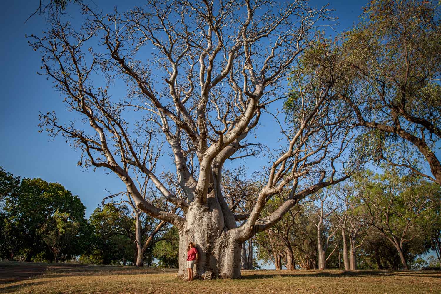
A majestic baobab tree – a living sculpture that can live for up to 1,500 years.
It is 5:52 am at Kununurra airfield. Annette and I board a four-seat Cessna 210. Pilot James starts the engine. Minutes later, we glide over vast sandalwood plantations whose strictly geometric rows look like a green chessboard in the morning light.
Then the landscape changes dramatically: beneath us stretches a jagged mosaic of rust-red escarpments, olive-green savannahs and hidden watercourses.
Dann erscheinen sie: die Bungle Bungles
The steel-blue waters of Lake Argyle penetrate the sandstone landscape like fjord arms. The vast reservoir covers an area of almost 1,000 square kilometres – nearly twice the size of Lake Constance. A sharp-edged escarpment runs through the savannah like a natural fortress wall.
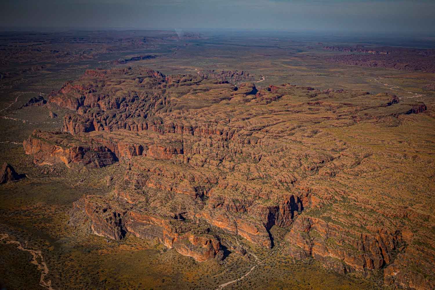
Then they appear: the Bungle Bungles. Orange-red rock towers whose conical peaks stack up to the horizon. Their horizontal banding, alternating between orange and dark grey, attests to sediment deposits from the Devonian period 360 million years ago.
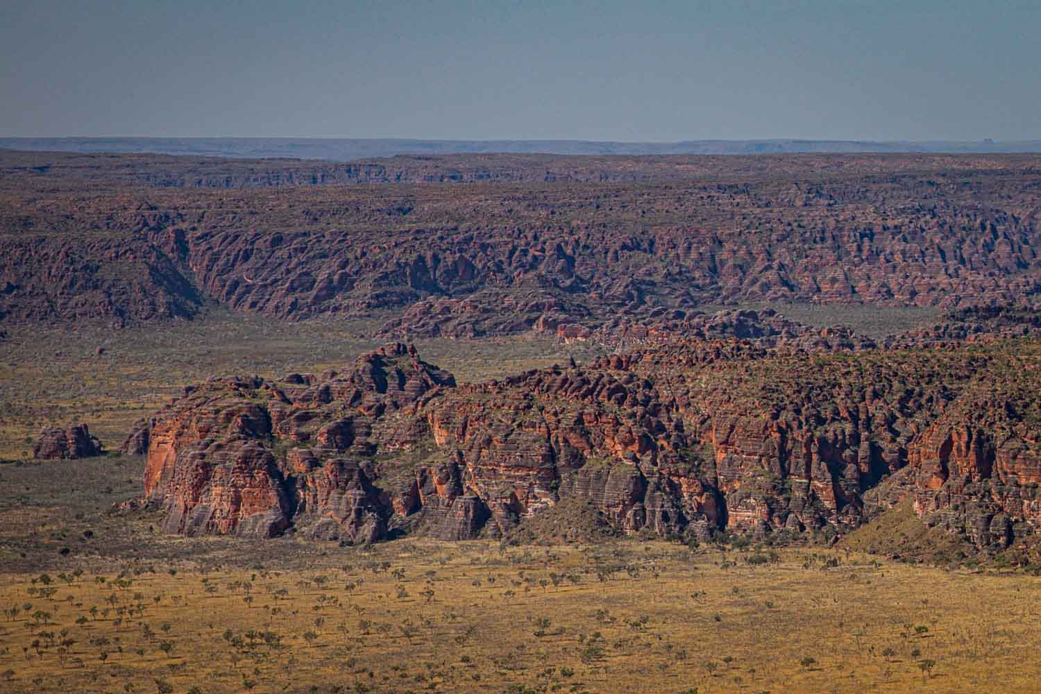
The characteristic orange-red rock towers of the Bungle Bungles rise from the green plain.
After landing, our guide Rebecca Sampy welcomes us. „Welcome to the ground you are standing on,“ she greets us. This phrase acknowledges that we are standing on land belonging to the Traditional Owners – the Kija and Jaru, whose connection to this place stretches back tens of thousands of years. Purnululu means ‘sandstone’ in the Kija language.
We walk through a landscape full of Livistona palms and shoulder-high spinifex grass. On a rock face, I spot the ochre-coloured imprint of a hand about five metres above us. Rebecca explains: „These handprints are over 17,000 years old. They mark significant places and express the connection of our ancestors to the land.“
The rock stores the day’s warmth and releases it at night
A termite mound clings to the rock face. Rebecca explains: „The queen and her larvae need a constant temperature of around 30 degrees. The rock stores the day’s warmth and releases it at night – a natural air conditioning system.“
Then she speaks about a subject that moves me deeply: „In earlier times, we used hollow termite mounds for burials. After a body had lain in a rock niche for four and a half months, the bones were placed in a termite mound. We believed that termites release the spirit more quickly, so it can return to the Dreamtime source. The mound serves as a portal between the physical and spiritual world.“
At a billabong, she cautions: „Treat this place with respect! No throwing stones into the water – that disturbs the spirits!“
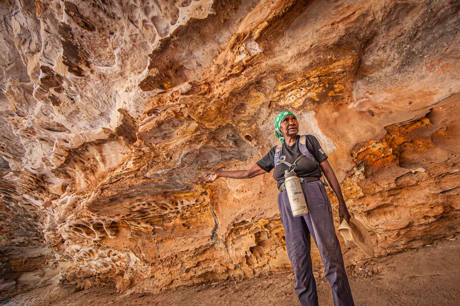
Guide Rebecca Sampy explores the rock landscape of Purnululu National Park with us.
Cathedral Gorge opens before us like a gigantic amphitheatre. Curved rock walls arch up to 200 metres high above a still pool of water – a sacred building crafted by nature. The acoustics are phenomenal: if someone speaks on the far side, it sounds as though they are standing right behind me.
The cleft narrows to barely shoulder-width
Later, we explore Echidna Chasm in the north of the park. The cleft narrows to barely shoulderwidth. The sheer rock walls soar over 200 metres, while golden light from above shows the way. Livistona palms cling to the vertical walls.
They date from a time when the climate here was significantly wetter. Today they survive only because their roots reach deep enough to access permanent groundwater.
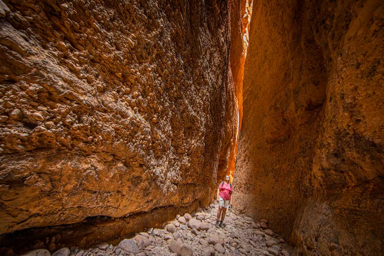
Echidna Chasm narrows to barely shoulder-width; the sheer rock walls soar over 100 metres.
The final leg takes us by air from the striped domes of the Bungle Bungles back to Broome. Our guide Bess, just fifteen years old, greets us with the composure of a veteran. „Broome was built on buttons,“ he explains. Until 1914, this remote coastal town supplied 80 per cent of the world’s mother-of-pearl.
The Pinctada maxima, the world’s largest pearl oyster, also made Broome the pearl capital of the planet. The history of this industry is steeped in colonial brutality.
In the 1860s to 1880s, Aboriginal men and women were forced to dive as skin divers, naked and without equipment, up to twelve metres deep. From the 1890s onwards, Japanese divers from Taiji – today a sister city of Broome – took over the dangerous work.
Before our eyes, Bess opens a Pinctada maxima
In 1956, Australia’s first pearl farm opened in Kuri Bay, 370 kilometres to the north. A tiny nucleus of Mississippi mussel shell is implanted into the oyster, and the creature coats it with mother-ofpearl. Two years later, harvesting can begin.
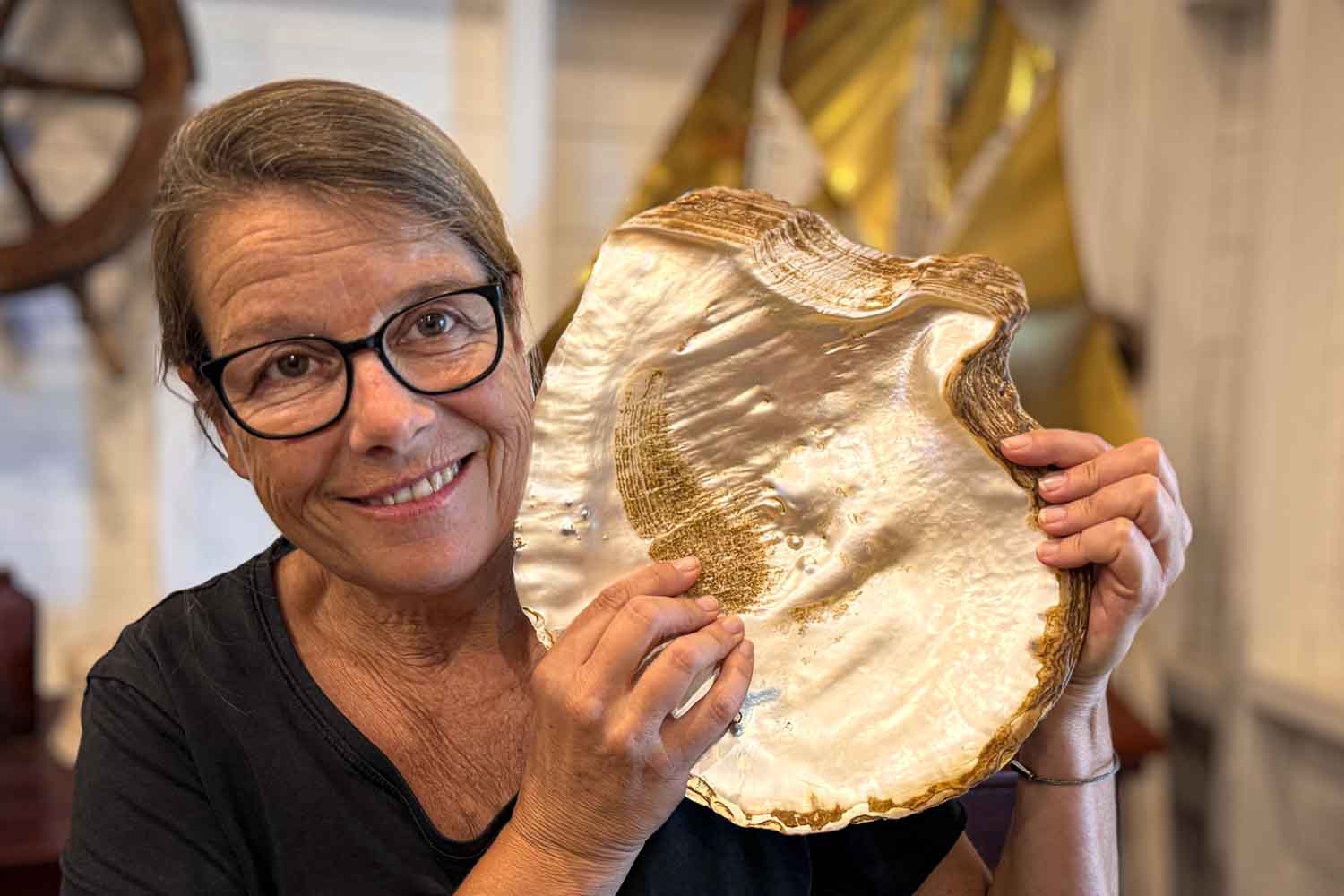
Before our eyes, Bess opens a Pinctada maxima. He carefully extracts a small, irregularly shaped pearl from the tissue – a keshi, formed without an implanted nucleus, a by-product of cultivation and yet of captivating beauty.
In the showroom, Bess places a flawless pearl in my palm. Around two centimetres in diameter, perfectly round, with that velvety lustre experts call ‘orient’. Bess grins: „100,000 dollars.“ The small keshi fetches 72 dollars by comparison.
In the evening, Annette and I sit at Cable Beach. The sun sinks blood-red into the Indian Ocean, camels parade as silhouettes across the wet sand. Ten days lie behind us. Gorges of 350-millionyear-old reef rock. Termite mounds like cathedrals. Rock walls that tell stories from the Dreamtime.
A land that doesn’t handle its visitors with kid gloves
Is it really as bad as they told us? No. It is overwhelming, challenging, humbling. A land that doesn’t handle its visitors with kid gloves, but moves them deeply for that very reason. The Kimberley region demands respect. In return, it gives back something no travel guide can describe: the feeling of having been to one of the last truly wild places on earth.
At Willie Creek Pearl Farm, a Pinctada maxima shimmers – the world’s largest pearl-producing oyster.
Hier können sie das TERRA Magazin bestellen:
Print Ausgabe Digital-Ausgabe
Lesen Sie jetzt: